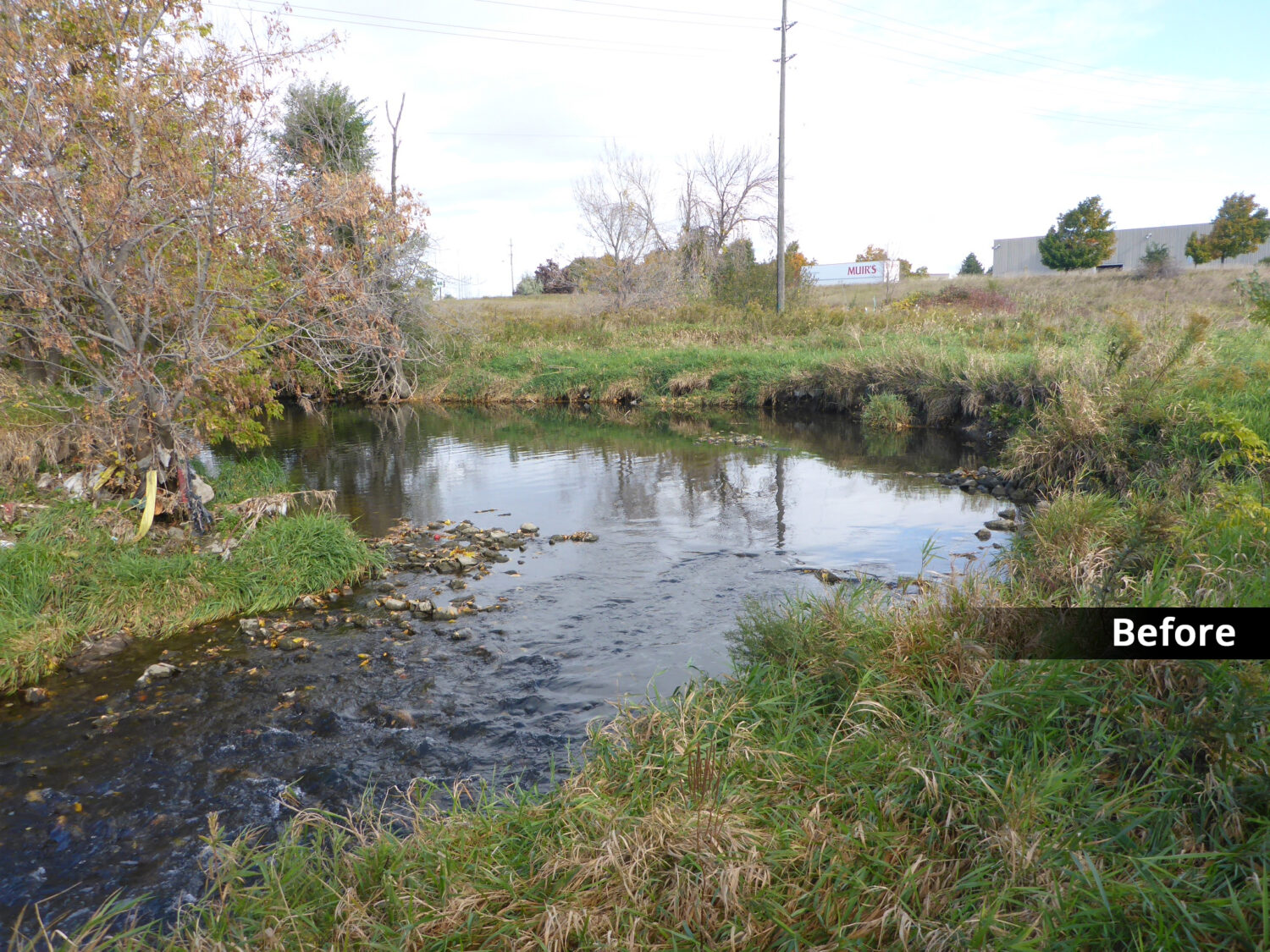
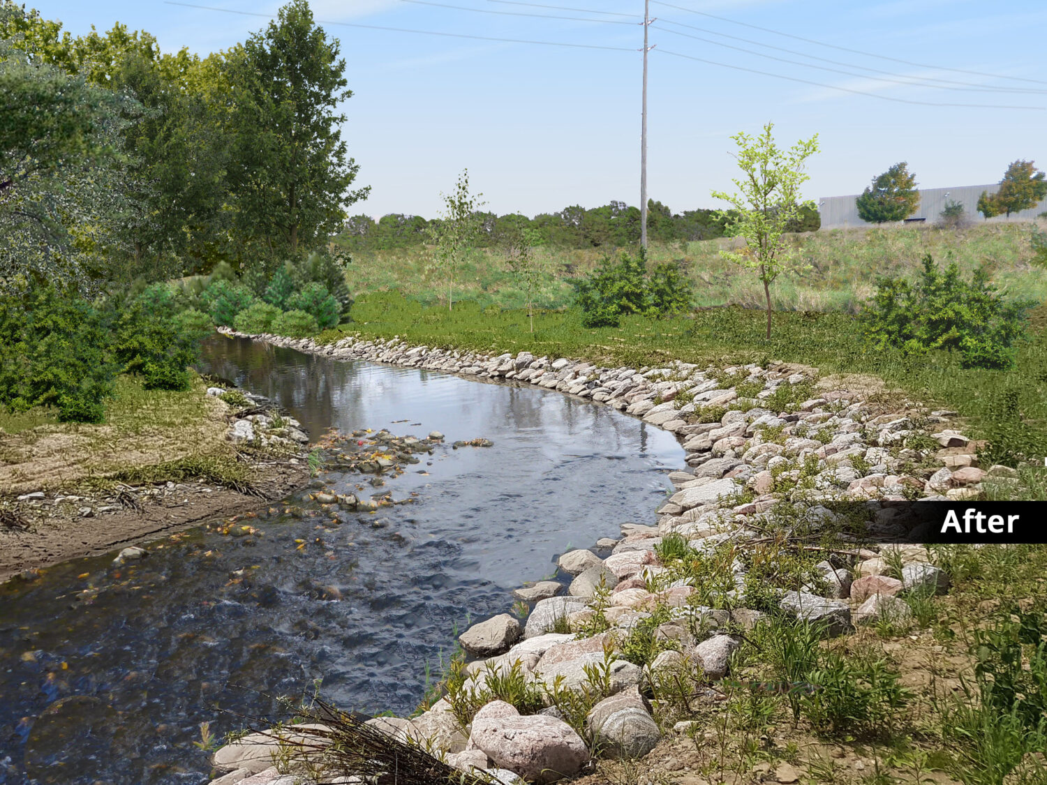
Solution
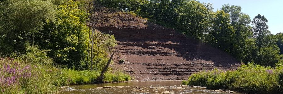
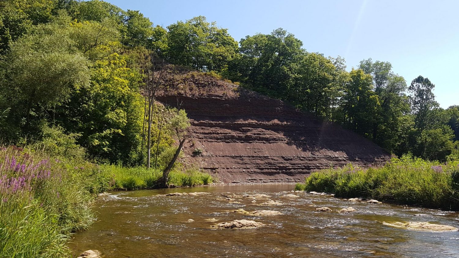
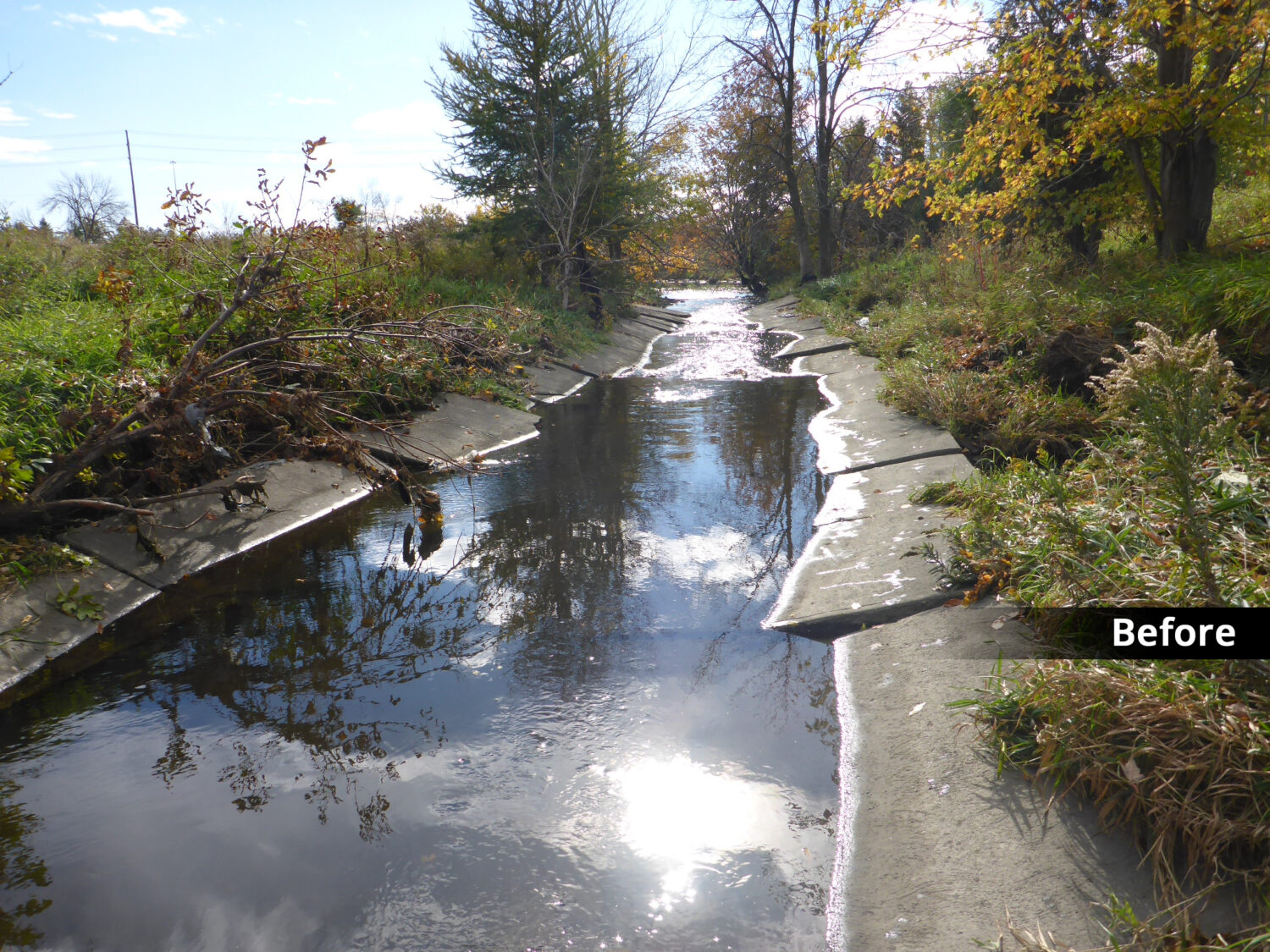
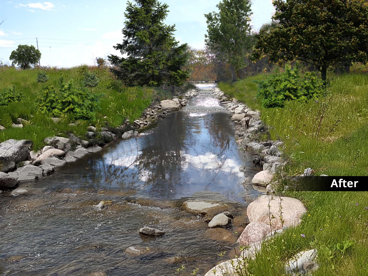
Characterization of past trends and the current state of the ‘health’ of watercourse systems is the first step in effectively protecting, managing and rehabilitating these systems. Beacon is experienced in assisting clients with all types of characterization requirements, from small-scale desktop assessments to large-scale geomorphological and sediment transport modelling projects.
Hydraulic and sediment entrainment modelling is a tool which can be used to support and complement field observations. At Beacon, in-house erosion models are used in the analysis of different land use or stormwater management scenarios. Flow and sediment transport models are also applied in relation to natural channel designs, bank stabilization measures and in-stream habitat structures.
Expertise
- Geomorphological inventories and characterization studies
- Geomorphic Systems Master Implementation Plans
- Sediment transport modelling
- Erosion threshold exceedance modelling and analysis
- Scour potential modelling and analysis
- Geomorphological and sediment transport monitoring
- Watershed-scale sediment routing (budget) analyses
